Hurricane Beryl is rapidly strengthening as it heads towards Barbados and the Windward Islands, threatening devastating hurricane-force winds and potentially life-endangering storm surges, CNN reported.
Devastating wind damage is expected where the eyewall of Beryl moves through portions of the Windward Islands. A life-threatening storm surge will raise water levels by as much as 5 to 7 feet above normal tide levels in areas of onshore flow near where Beryl makes landfall in the hurricane warning and watch areas, the National Hurricane Center said.
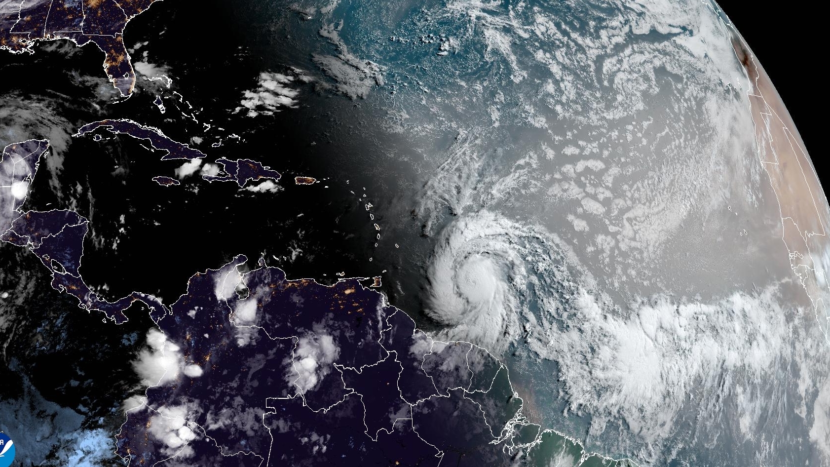
The NHC reported Beryl as expected to become an “extremely dangerous” Category 4 hurricane when it reaches the Windward Islands by late Sunday or early Monday. Hurricane Beryl is about 465 miles east-southeast of Barbados and delivers maximum sustained winds of 100 miles per hour, the hurricane centre said in its update. Barbados, St Lucia, St Vincent and the Grenadines and Grenada remained under a hurricane warning. Martinique, Tobago and Dominica were under a warning, the NHC said in its latest update.
The NHC said that by about 5:00 a.m. (0900 GMT) Sunday morning, the maximum sustained wind speed at Beryl had strengthened to nearly 100 miles per hour with stronger gusts. The hurricane is intensifying rapidly, with wind speeds increasing from 35 miles per hour to 75 miles per hour in less than 24 hours, while the norm is 35 miles per hour within 24 hours.
We’re forecasting rapid intensification and expecting Beryl to become a major hurricane before it reaches places like Barbados and the Windward islands and continue to be a powerful hurricane as it moves into the eastern and central Caribbean as we go into the early portions of next week, Mike Brennan, Director of the National Oceanic and Atmospheric Administration’s National Hurricane Center, predicted.
According to Brennan, residents in places where hurricane warnings are in place should be ready for the storm’s severe impacts, as the hurricane carries the risk of torrential rains, damaging hurricane-force winds and dangerous storm surges and waves. In addition, the storm is now just 11 miles per hour short of reaching “major” hurricane status, a Category 3 or higher hurricane that can lead to devastating impacts.
Experts say such a powerful storm forming so early in the Atlantic hurricane season, which runs from early June to late November, is extremely rare, as the average date of the first hurricane is 11 August. The agency cited high Atlantic Ocean temperatures and conditions associated with the La Niña weather event in the Pacific Ocean as the reason for the expected increase in storms.