An earthquake with a magnitude of 7.3 on the Richter scale struck the small island nation of Vanuatu, the US Geological Survey said. Vanuatu is located to the east of Australia in the New Hebrides archipelago and occupies more than 80 islands.
The epicentre of the quake was about 30km from the capital Port Vila, at a depth of about 57km. Six minutes later, there was a second tremor in the region with a magnitude of 5.5.
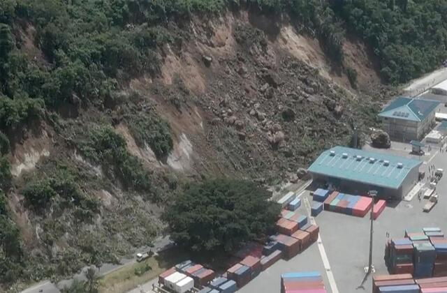
Local media reported that at least one person died and the injured were taken to hospital. The road connecting Port Vila to the international shipping terminal was blocked by landslides and most mobile phone networks were down.
Footage posted on social media showed bent windows and collapsed concrete columns in a building housing foreign missions including the embassies of the US, Britain, France and New Zealand. Australian broadcaster 7News showed footage of the devastation on neighbouring islands.
Vanuatu, located on an archipelago of 80 islands, is home to about 330,000 people. A total of 73,000 people experienced strong tremors, CNN reported, of which 36,000 were residents of Port Vila.
The website of the US Embassy in Papua New Guinea says flights to and from Vanuatu have been cancelled. There are also reports of landslides in the Port Vila area. People are advised to avoid entering buildings as they may be damaged or unstable.
The US Geological Survey said the depth of the quake suggests it occurred beneath the Australian and Pacific plate boundary in the Coral Sea region. In this region, the Australian plate is moving east-northeast relative to the Pacific plate at a rate of about 85 mm/yr.
The area where the Australian and Pacific plates meet is one of the most seismically active in the world. This is the 25th earthquake in the last 100 years. The largest recorded event in this region was a magnitude 7.9 earthquake about 86 kilometres to the southwest in December 1950.
